FAQ
If you don’t see your question here
TRANSPORTATION SYSTEMS MANAGEMENT & OPERATIONS
What is Transportation Systems Management and Operations (TSM&O)?
TSM&O is a national initiative that is supported statewide. It promotes the integration of proven transportation management strategies to our existing roadways to improve the traffic flow and people-moving capacity of South Florida’s regional transportation network.
The program takes a collaborative approach to traffic management. It enables FDOT to work with partner agencies to deliver multi-modal solutions to reduce congestion. The goal is to equip existing roadway systems with the innovative tools and techniques that will allow it to meet current and future traffic demand.
What is the SunGuide Transportation Management Center (TMC)?
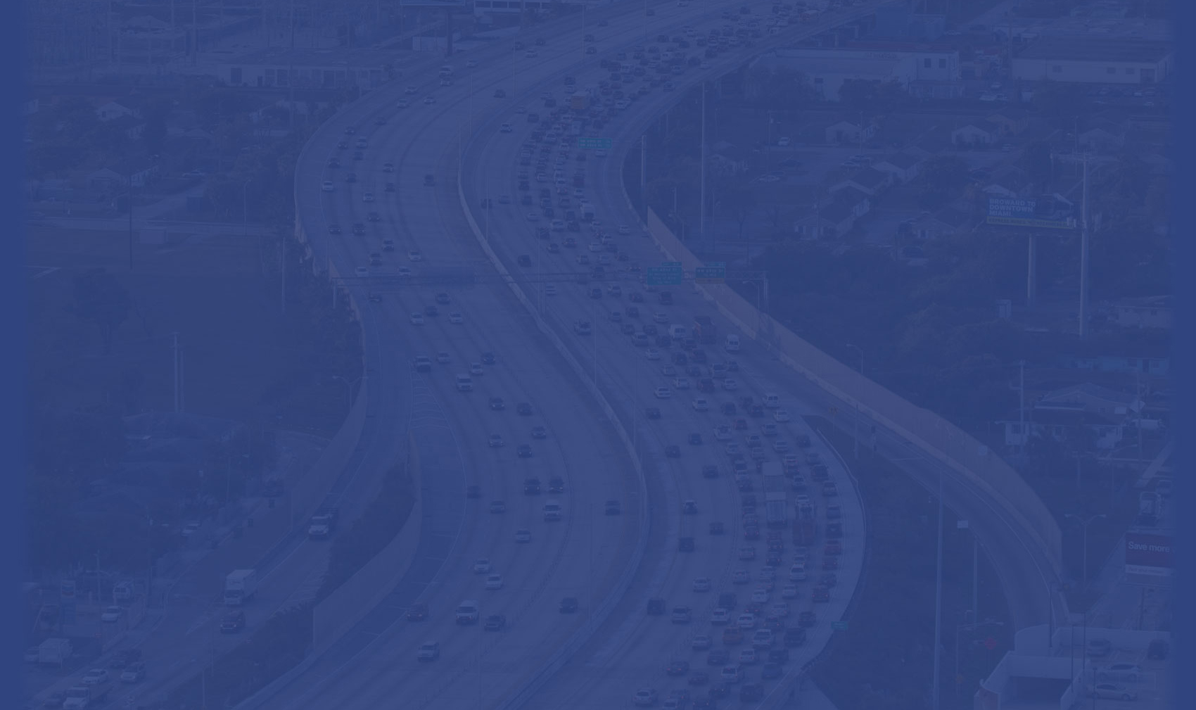
The SunGuide Transportation Management Center is 32,000 square foot facility that opened in 2004 to manage regional traffic in South Florida.
The center houses the TSM&O program where traffic operators monitor the roadways 24 hours per day, 7 days per week. They work with partner agencies to provide incident management, traveler information, and arterial management services to the area.
The SunGuide TMC houses a traffic control room that features a large video wall and 18 operation workstations.
What agencies work with the SunGuide TMC?
The SunGuide TMC houses partner agencies such as Florida Highway Patrol Troop ‘E’, Greater Miami Expressway Authority, City of Miami Beach and other regional partners. The collocation of these agencies promotes a collaborative and seamless approach to traffic management in the region.
How does FDOT use technology to manage traffic in District Six?
FDOT District Six uses advanced Intelligent Transportation System (ITS) technologies, such as cameras, dynamic message signs, and roadway sensors to monitor traffic conditions across Miami-Dade and Monroe Counties. These tools communicate with the SunGuide TMC through a secure fiber-optic network, allowing traffic operators to respond to traffic conditions in real time. For a complete list of devices, click here.
What is the goal of the District Six SunGuide TMC?
The goal of the District Six SunGuide TMC is to provide safe and reliable roadways for the motorists of Miami-Dade and Monroe Counties. It aims to plan, manage, operate and maintain the District’s TSM&O Program and the services it provides 24 hours per day, 7 days a week, 365 days per year.
The goal is to serve as the region’s traffic management and command center that coordinates with other agencies to formulate the appropriate response to minimize delays and increase safety conditions.
Where is the SunGuide TMC located?
The SunGuide TMC is located at 1001 NW 111th Avenue, Miami, Florida 33172. Public tours may be requested through the Contact Us page on SunGuide.info.
INCIDENT MANAGEMENT
What is the Incident Management Program?
The Incident Management Program provides coordinated roadway assistance and vehicle response services to help clear crashes, remove hazards, and keep traffic moving safely across District Six highways. These services are managed by the SunGuide Transportation Management Center (TMC) and include the Road Ranger Service Patrol, Incident Response Vehicle (IRV), and Rapid Incident Scene Clearance (RISC) programs.
What is the Road Ranger Service Patrol?
Road Rangers are FDOT’s front-line responders who provide free motorist assistance and traffic control along major highways in Miami-Dade County, including I-75, I-95, I-195, I-395, SR 826, and their Express Lanes.
Road Rangers perform a variety of incident management and motorist assistance services, including:
- Setting up maintenance-of-traffic (MOT) during incidents.
- Clearing disabled vehicles and debris from travel lanes.
- Providing jump-starts, flat tire changes, and minor vehicle repairs.
- Offering two free local calls to stranded motorists.
- Assisting emergency responders and monitoring abandoned vehicles.
Are Road Ranger services free to the public?
Yes. The Road Ranger Service Patrol provides all assistance free of charge to motorists. Their goal is to ensure safety and maintain traffic flow—not to issue citations or charge for service.
How can I reach the Road Rangers for help?
If you need roadside assistance, dial *347 (* FHP) on your mobile phone. This connects you to the Florida Highway Patrol, who will dispatch a Road Ranger or other appropriate responder within the states roadway system.
What is the Incident Response Vehicle (IRV) Program?
The IRV Program is staffed by operators with law enforcement or fire rescue backgrounds who serve as FDOT’s on-scene coordinators during major incidents.
IRV units:
- Operate major highways in Miami-Dade County, including I-75, I-95, I-195, I-395, SR 826, and their express lanes.
- Carry specialized tools such as spill absorbents, traffic cones, signs, and repair materials.
- Coordinate and serve as the key communication link between emergency response agencies and the TMC.
What is the Rapid Incident Scene Clearance (RISC) Program?
The RISC Program is a performance-based initiative designed to quickly clear major crashes involving heavy vehicles and spilled loads.
- Activated by the TMC in coordination with FHP.
- Incentivizes qualified tow and recovery companies to restore highway capacity faster than traditional methods.
- Available across District Six highways and select arterial roadways in Miami-Dade County.
Which team responds to what type of incident?
Which team responds to what type of incident?
- Road Rangers: Handle minor crashes, disabled vehicles, and debris removal.
- IRV Operators: Coordinate major incidents and ensure agency collaboration.
- RISC Contractors: Manage heavy-duty crash recovery and hazardous debris clearance.
Together, these teams form the backbone of FDOT District Six’s Incident Management Operations, keeping our roadways safe and efficient.
To learn more about how The Traffic Incident Management (TIM) serves South Florida Six, click here.
TRAVELER INFORMATION
What is Traveler Information?
Traveler Information provides drivers with real-time traffic data to help them make informed decisions before and during their trips on Florida’s roadways. This information is shared through the Florida 511 Traveler Information System, Dynamic Message Signs (DMS), and other FDOT communication tools. Travel times and alerts are based on data gathered from roadway detectors that monitor speeds and volumes in real time.
How is Traveler Information generated?
FDOT collects traffic data using roadway detectors placed roughly every third of a mile along Florida highways. These sensors operate around the clock, sending speed and volume data to the SunGuide software. The system analyzes the information to create travel time estimates and display alerts about congestion, crashes, and other incidents.
What are Dynamic Message Signs (DMS)?
The 511 Traveler Information System is a service provided by the Florida Department of Transportation (FDOT). It is the statewide service that provides real-time traffic reports through its website or phone system. For more information on how to use the new system, click here.
What is the 511 Traveler Information System
Dynamic Message Signs are electronic boards located along highways and arterial roads. They provide real-time updates about lane closures, crashes, travel times, and safety messages. Operators at the SunGuide Transportation Management Center (TMC) monitor roadway conditions and update these signs to help motorists avoid delays and stay informed.
What is FL511?
FL511 is FDOT’s official traveler information system. It provides real-time updates on traffic conditions, construction activities, and roadway closures throughout Florida. The service is available online at FL511.com, on the mobile app, and through social media platforms including Facebook, X (formerly Twitter), and Instagram.
What are the benefits of using FL511?
FL511 allows travelers to plan their routes more efficiently, avoid congestion, and stay informed about travel times, construction, and emergency events. The system helps drivers make smarter travel choices and reach their destinations safely and on time.
Does the SunGuide TMC have social media accounts?
No. The SunGuide Transportation Management Center itself does not maintain social media accounts. However, FDOT District Six uses its official social media channels to share planned events, construction alerts, and real-time traffic information for the South Florida region. These platforms include Facebook, YouTube and X .
EXPRESS LANES & RAMP SIGNALING
What are Express Lanes and how do they work?
Express Lanes are congestion management projects designed to improve highway reliability and mobility for all drivers. These lanes use variable toll pricing, meaning the toll amount changes with traffic conditions — prices rise as lanes become busier and drop when traffic is lighter. This system helps maintain consistent traffic flow and shorter travel times.
Who can use Express Lanes?
Any driver with a SunPass® transponder or a Florida-accepted interoperable transponder can use the Express Lanes. The transponder must be properly installed in the vehicle before entering. To learn more or purchase a SunPass, visit SunPass.com.
Which Express Lanes does FDOT District Six operate and maintain?
District Six manages several Express Lane corridors that form part of South Florida’s regional Managed Lanes network, including:
- 95 Express (I-95): Extends from downtown Miami to Palm Beach County.
- 75 Express (I-75): Serves northwest Miami-Dade County and connects to major interchanges.
- Palmetto Express (SR 826): Enhances mobility along one of South Florida’s busiest travel corridors.
These projects are part of a broader regional effort to reduce congestion, promote transit and high-occupancy travel, and improve system connectivity. For more information, visit the FDOT Managed Lanes Program.
What are Ramp Signals and how do they work?
Ramp Signals are traffic lights installed on highway entrance ramps that control the rate of vehicles entering the highway. They alternate between red and green lights to space out merging traffic, improving safety and reducing congestion on the mainline. Most signals operate during weekday rush hours or when traffic is heavy. Each signal uses sensors to adjust its timing based on real-time traffic conditions. Some ramps allow one car per green light, others two, depending on ramp design and traffic flow. Ramp Signals in Miami-Dade County are monitored by traffic operators at FDOT’s District Six SunGuide Transportation Management Center.
How do Ramp Signals improve traffic flow and safety?
Ramp Signals help drivers merge safely onto the highway by spacing vehicles as they enter. This prevents the “bottlenecking effect” that occurs when too many cars merge at once, which slows mainline traffic. Published traffic studies have shown that Ramp Signals can improve mobility, reduce congestion, and shorten overall travel times. The short wait on the ramp is offset by faster and safer travel times once on the highway.
Why are some Ramp Signals turned on while others are off?
Ramp Signals operate based on real-time traffic needs. For example, signals may be active on northbound ramps during afternoon rush hours and on southbound ramps in the morning. They can also turn on outside of peak hours if an incident or special event causes congestion. The goal of ramp signals is to manage merging traffic only when necessary to keep the mainline flowing efficiently.
Do Ramp Signals cause congestion on nearby city streets?
Ramp Signals are designed to improve traffic flow on the highway without impacting local streets. They have traffic sensors that detect if queues on ramps are getting too long and adjust the signal to release vehicles faster. Traffic Operators at the Sunguide Transportation Management Center also use dedicated closed-circuit television cameras to monitor ramp traffic and make real-time adjustments if needed.
What should drivers know when using a signalized on-ramp?
When the light is red, stop at the white line until it turns green. When it’s green, one or two vehicles (as posted) may proceed and merge onto the highway. Always follow posted signs and remain patient, short ramp delays help improve your overall trip time. Remember that ramp signals are traffic control devices; failing to obey them can result in a traffic citation enforced by the Florida Highway Patrol. Please see animated video on how to properly use Ramp signals here.
Where can I learn more about ramp signals?
You can learn more about how FDOT uses ramp signaling here FDOT.GOV: Ramp Signaling.